
Electronic Rule Based Urban Planning For Greece Government.
Our Solutions
The Overview
Introduction
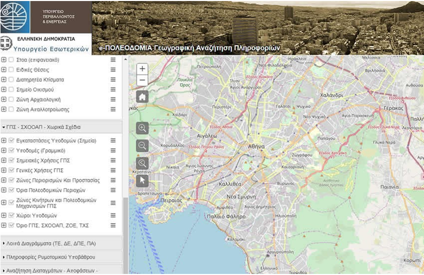
PIS, which offers valuable geospatial information with a few clicks, for the approved city plans and other urban planning administrations. At the same time it builds new procedures for the control, approval and publication of urban studies, which remains to be proved in practice that they will proceed on the basis of the timetable.
SOLUTIONS
Spatial Planning Basis, up to the square quadrature for the in-plan areas and appropriate polygons for in-boundary settlements and off in accordance with the applicable town planning legislation
Applications for the search, display, downloading, transformation and invocation of the urban data.
Registrations & Updating of Geospatial Data of Spatial Planning Regulations.
Implementation to support the procedures for correcting and completing geospatial data already registered in the System of Spatial Planning Regulations.
Implementation of User classified Access.
Application for conversion of Geospatial Data into GML FIle for Open Data Exchange Model.
RESULTS
This solved the concerns of the public geospatial data of the existing town planning legislation, which defines the ownership, construction, exploitation or protection of real estate, and it is also an important step in modernizing the public administration and the services it offers in the real estate sector. It provides for the more efficient operation of the service, with the possibility to immediately inform about the special conditions - terms, building restrictions, and the existing town orders.
It improves the efficiency of the internal processes of the urban planning services and their operation, significantly enhancing the .