
Estimating Solar Potential With Rooftop Mapping
Our Solutions
The Overview
Introduction
Rooftop solar photovoltaic (SPV) systems, especially in Indian solar cities, there is a need for a tool to showcase solar resource potential in a user-friendly format so that users can investigate their locations of interest and perform pre-processed analysis. GIS is the obvious tool to achieve this because it provides a visual reference – a map of the entire city showing the buildings that have solar PV installation potential. An important part of every webbased GIS tool is its mapping or, visualization technology, which makes it possible to show data in maps.
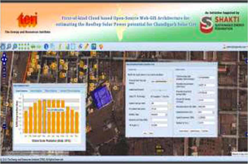
SOLUTIONS
We developed a first of its kind Cloud based open source web GIS solution to calculate potential solar radiation on rooftops of buildings . Mapping the rooftops and integrating it with NREL data for solar radiation. This consisted of rooftop area, height, surrounding, etc. and would calculate solar potential based on 8 solar parameters and also share estimation on solar potential of the POI. We estimated the potential for rooftop solar energy generation by conducting a geo-spatial survey of more than 40,000 buildings as well as a solar radiation survey of more than 10,000 buildings using solar meter.
The process involved assigning attributes which were required to reach the desired objective. The analysis of the data and Results were then presented on the application for the user.
RESULTS
Acting as a Decision Support System (DSS) to carry out the pre-feasibility assessment of putting rooftop PV system for a particular location.
Helping users to estimate potential green-house gas (GHG) mitigation through solar rooftop route for a given location/building.