
GIS is the future of Risk Management in AgriBusiness.
Our Solutions
The Overview
Introduction
According to the FAO, the growth rates of global agricultural production and crop yields have slowed in the last couple of years, raising fears that the world may not be able to grow enough food and other commodities to ensure that future populations are adequately fed. Considering climate change as an important factor in world farm production, the growth rates of global output may further be endangered by failure of rains and occurrence of natural disasters such as floods and droughts leading to crop failures, food insecurity, famine and mass migration together with negative national economic growth. That’s why the risk management in agriculture is becoming an important tool for farmers to anticipate, avoid and react to shock, and thus mitigating risk and uncertainty in agriculture.
SOLUTIONS
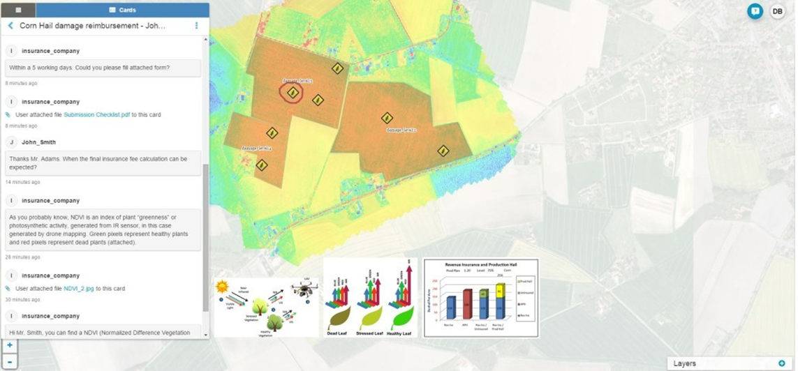
The insurance company used drone generated NDVI map to have an overview of the hail damage in corn. This was a pilot project designed for improving their agriculture risk assessment process. They needed a solution for field inspection, data sharing, and collaboration between the parties involved in an insurance claim case.
Insurance company consultants and analysts can use NDVI data to determine the intensity of crop fields damage by analyzing NDVI pixel intervals using the NDVI map (with a scale range from -1 to +1). Inanimate or dead material (roads, buildings, soil or dead plants) is displayed in red, while plants are displayed in green, making the hail damaged area easily visible on a map. This analysis helps to generate parameters for insurance claim assessments.
After finishing the scouting process, consisted of observing the mapping data combined with the field sample inspection, insurance provider needed to verify survey data and create a damage assessment.
When the preliminary assessment phase was finished, insurance provider needed to share the data with interested sides, in this case, farmer whose crops were damaged and the Agricultural Development Authority providing one-time support to the farmers in the case of hail.
RESULTS
The product is a great decision-making tool, helping agricultural agencies and companies to improve their understanding of the data in a fast, accurate and efficient process.