
Detection of Underground Utility for Metro.
Our Solutions
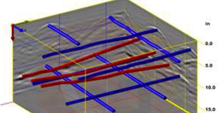
The Overview
Introduction
Underground utility maps are often wrong – if they exist at all. Sometimes utility pipes or cables Urban Underground Infrastructure are relocated during repairs or renovations, but maps are not updated. Sometimes maps represent proposed plans that don’t show asbuilt locations. Sometimes, old maps are simply lost or disintegrated. The result of digging or drilling in the presence of the unknown, unmarked, unmapped, or incorrectly located utilities can be wasted excavation time (and money), expensive damage (more money), utility downtime (more money), and worst of all – personal injury or death.
SOLUTIONS
Real-time detection of buried utilities (pipes, cables, etc.) for excavation planning and damage avoidance.
Utility relocation design, coordination and cost estimates.
Pipes and cables location on CAD maps.
Communication of utility data to concerned parties.
Subsurface Utility Engineering.
Capturing Utilities: water and gas pipes, electrical and communication lines.
Capturing Irrigation Information: pipes, sprinklers, valves, controllers, and irrigated areas.
Site Plans: buildings, evacuation points, emergency info, fire hydrants, and chemical storage areas.
After the utilities have been located, they are marked using color-coded pavement paint as well as color-coded flagging. Have you ever pulled into a parking lot or a gas station and noticed the lot is spray painted with assorted colors? Have you ever driven through a neighborhood and noticed a yard with many small, colored flags throughout it? Those markings are utilities that have been mapped out and located!
RESULTS
In the last few years, there has been a growing recognition of the benefits of accurately geolocating underground infrastructure and the business opportunities this creates. The business benefits of accurate geolocation of underground infrastructure have been documented by a number of ROI studies. Some countries, municipalities, utilities and communications companies around the world have created 3D models of underground utility infrastructure.